
Pathway to be completed by June
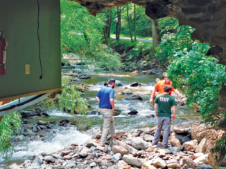
At its last meeting, the Cornwall-on-Hudson Board of Trustees approved Nat Stillman’s proposal to complete the Round Top Park trail. On April 27, a dozen hikers joined George Muser, secretary of the Hudson Highlands Nature Museum’s Board of Trustees, on a trek along the trail.
The excursion was part of the museum’s annual Hike-A-Thon and began at the Wildlife Education Center (WEC), which sits on a 44-acre chunk of property given to the village and later leased to the museum.
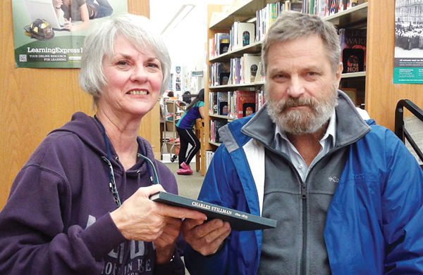
The Stillman family still owned four acres next to the WEC. When Nat Stillman’s mother died two years ago, he bought out his brother and sister’s share of the property so a trail could be completed.
“For the last 70 years, since the park was donated to the village, there’s been this obstacle – a rock outcrop – preventing museum comers from getting to the top of roundtop,” Muser said as the group started its journey. “It has a spectacular view. It’s so unvisited, when I was up there at the start of this development, there wasn’t a single piece of trash. It was absolutely pristine because it’s been blocked all this time.”
The trail currently under construction will take hikers around that rock outcropping. Matt Brady, manager of Black Rock Forest, has been tasked with completing the trail, which he anticipates finishing in June.
Phase two of the project, Brady said, will be completing a trail down to Roe Park. He said the loop trail will be completed by September.
The trail begins just to the right of the parking area in front of the Wildlife Education Center. In the future, a trailhead kiosk will provide maps.
To begin, hikers had to beware of a shallow gully formed by rain the night before, leaving some rocks wet and slippery. Muser noted only a portion of the trail has been blazed (markings on trees to keep travelers on the right path) and the uncompleted portions are marked out with ribbons tied to trees.
After a short walk, the trail comes to an old road which Muser explained leads to the old Stillman farm.
Eventually the trail enters Stillman’s four-acre parcel. Although Brady has cleared a small area, the path is blocked by a chain link fence. At the end of the path is Whit’s Falls, named after Stillman’s brother, Whitney. The stream which feeds the falls crosses under the WEC and the Boulevard.
After the brief stop, the hike continued to a stone bridge. On the other side of the bridge is a bench, installed by Brady. The bench overlooks the bridge and another small waterfall.
It was here the group stopped to admire a burrow on a tree. One hiker explained the growth is a result of the tree’s reaction to an infection. He said artists like to use the burrow for carvings because of the unique grain of the wood.
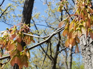
The trail eventually exits the four-acre property and comes upon its first scenic viewpoint. To the southwest is Schunnemunk Mountain and to the northwest Route 32, in New Windsor, is visible.
As you walk a bit further, the grade starts to get a bit steeper where the trail isn’t complete. When finished, the trail will have 15 to 20 percent grades, when necessary, but with possible steps in some areas. Brady said he’s aiming for 10 percent inclines.
“I’m trying to follow the contour lines as best we can to minimize the work and disturbance,” he said via e-mail.
Muser said the trail doesn’t go in a straight line so hikers aren’t looking directly into homeowners’ backyards. He added trails are often designed to pass by interesting terrain features. Stopping at a tree adjacent to a large depression in the ground, Muser queried the crowd as to what caused it. Guesses included the root hole of a tree, as well as the foundation of a man-made structure. Muser suggested people may have dug for iron there given the evidence of nearby tailings.
After a little legwork, the hikers eventually reached the top of the park which opens up to a small meadow. Some cheered as they took in views of the Hudson River and the village below. Cornwall-on-Hudson Elementary School and Cornwall Presbyterian Church were clearly visible. So too was a passing train along the riverfront. Although the sky was overcast, the tower on top of Mohonk Mountain was visible, an estimated 30 miles from the village.
After everyone had their fill of the view and had taken all the photos they wanted, Muser led the way back to the bottom.
The entire hike took less than an hour and covered two miles, round trip.